I had agonized for a while over the summer as to whether to make my usual trip to the Alps or head to the Pyrenees or to head back to the place of my most recent adventure, Norway to further explore the place that captivated me in June and Norway won the day. The last time I was there I visited Romsdal, Dovrefell and Rondane and each place was different and delightful. This time I decided to go to Jotunheimen and explore the "land of the giants".
Tuesday August 30th;
 |
| Camping in Lom |
 |
| The Otta River |
I travelled up to Dublin airport the previous night and spent an uncomfortable night in the airport waiting for my morning flight (I think I'm getting too old for that stuff) and its fair to say that I was thoroughly wiped in the morning. In my defense I had put down a physically demanding couple of weeks as I built a 24ft by 12 ft block built shed at the end of the garden. I was in need of a rest and a self sufficient hiking trip was perhaps an odd choice for that. I waited zombie like for the flight which left on time and I guess I slept for a lot of it as I cannot remember much of it. I travelled by train from Rygge to Oslo and from there to Otta. I caught a bus across to Lom where I stayed the night in a campsite. It all worked out in the end but the train was having problems which meant that I didn't arrive in Otta until 17.44 and the bus was leaving at 17.45 so I had literally no time to spare, but I did catch it. Still sleep deprived I wasted no time after dinner in settling down for the night and I caught up on some shut eye.
Wednesday August 31st;
I was feeling much better this morning and I was also delighted to find that it was a dry and pleasant morning so I would at least start off the trip in decent weather before the forecast rain arrived. I had hoped to start my trip at the Spiterstulen refuge and end up in Gjemdesheim but as I was once again outside the short peak season in Norway the bus services had been curtailed and I had to revise my options. I thought that there was bus to another refuge further south Leirvassbu but at the campsite I found out that the bus didn't visit the refuge but passed the junction for it which meant I had to walk for 13 kilometers to reach it. I didn't care though as I would at least be entering the wilds and I knew I could formulate a plan. After picking up a final couple of bits of food I caught the bus at 08.30 and alighted some fifty minutes later in the heart of majestic wild countryside.
 |
| Just off the bus and this is my route in |
 |
| Looking back towards Lom |


Though my bag was heavy (really heavy, perhaps almost 20kg) as I carried enough food for six days, I felt buoyant and excited to be once again setting off into the wild countryside. I love these moments when the hike is just beginning and it doesn't matter whether I'm in the Beara Peninsula,The Lake District, The Pyrenees or in Norway the feeling it the same, a mix of excitement and anticipation. It helps of course if the weather is nice and it certainly was this morning. The lane that goes to the refuge runs from north to south along a deep valley where the mountains of the Galdhopiggen massif form the western ramparts and the glaciers and ridges of the Smorstabbtindan massif loom over the eastern side. I was instantly captivated and felt great as I set off. The going is easy and while I'm not a great fan of walking on tarmac I didn't mind this morning as I knew I would soon leave it behind. As I was starting at about 900 mtrs and the hut was at just over 1400 mtrs I was allowing about four hours to reach it and while I didn't plan on staying there I would see what the weather was like etc when I reached it.
 |
| Mountaineering challenges everywhere |
 |
| Glaciers come down quite low |
 |
| Finally nearing the refuge |
 |
| I camped on the ridge in centre not far from the snowpatch |
On the west side of the valley there were no glaciers to be seen as they were hidden behind the 2000ft plus steep rocky ramparts of those mountains. On the other side valley after valley contained a glacier that flowed down to an elevation of around 1500 mtrs and interesting looking ridges cut the sky in between. It was wonderful to look around and soak in the majesty of the scenery all around. The weather was holding up pretty well also and it wasn't until midday that things started to get a little gloomier. I stopped for a good rest at the info board where the Storbrean glacier reached the roadside in the 1750s before setting off again on the now steeper roadway. Eventually I reached the hut complex around lunchtime and by now there was a promise of the forecast bad weather in the air. I decided to push on a bit further and find somewhere quieter to pitch my tent. I was now on the walkers trail and I followed the red Ts around Leirvanet lake and headed for the pass at Hogvaglen. I should point out now that the views in the area are beautiful as you might expect and the shapely peak of Kyrkja 2032 mtrs dominates the skyline across the lake. Anyway after about a kilometer I set about searching for a likely spot for the tent. It wasn't that easy to come by as the ground was mostly rocky and any mossy or grassy patches were exposed to the full extent of the increasing breeze/wind that only threatened to strengthen further as the weather dis-improved. After some looking I eventually settled on a spot on the ridge that led to the pass at around the 1500 mtr contour and I wasted no time in setting up camp.
 |
| Kyrkja dominates the skyline |
 |
| Heading for the saddle |
 |
| Yes the lake is that blue |
After a hot brew and a nap I found that the rain still hadn't arrived so I kinda forced myself to exit the cozy sleeping bag and I headed off to climb the nearby Krykja at 15.30. It was only a 6 kilometer round trip which I hoped I could get done before the rain set in. As you might expect my luck ran out and at 16.00 the rain finally arrived. I had made swift progress with just a light backpack but the going became more treacherous now as the rocks became water slick. I donned my rain gear and after a brief discussion with myself I decided to keep going up. I reached the saddle (1755 mtrs) under the summit cone at 17.00 (it always seems to take a little longer than you expect in the big mountains) and I wasted no time in heading for the summit. The wind was pretty strong here and the rain was being blown sideways and getting heavier. While the route looks steep it is never difficult and height is gained rapidly. Some nice little scrambly sections present themselves and as you near the top some Grade 2 scrambling is needed to gain the top. I stood on the by now rather bleak 2032 mtr summit at 17.40 and since the cloud had long since obscured any view I started my retreat immediately. I retraced my steps and I was back in my tent before 19.00 trying to separate my soaked outer shell from the nice dry stuff in the tent. I set about cooking dinner in the porch and had a good laugh when a passing sheep stuck her head in the vent and had a good look at me and my dinner before deciding to move on. Even though the weather was now pish I was pleased with the day and satisfied with my effort. I had covered over 20 kilometers and climbed over 1200 mtrs so I felt I had made a worthy start to the adventure. Heavy rain and strong winds made for a fitful nights sleep but I was glad to be back in the wild.
Thursday September 1st;
It had rained all night and it was still raining heavily this morning. I wasn't looking forward to trying to get packed up in the rain so after eating at just after 7am I settled down to wait for a lull in the rain which duly arrived at 08.30. I wasted no time packing everything up and I just about got it all done just as the rain came back. Wow it was chilly and the tent poles felt positively freezing as I packed them away. I reckoned it must have been in the low single figures temperature wise and I was perhaps regretting not having gone to the Pyrenees instead. Still once I was moving for a while I began to feel better and by the time I was over the pass at Hogvaglen I was once again enjoying myself. Today I was heading towards Gjendebu hut (for a start) and I had the makings of a plan for the next few days. My route would return to Spiterstulen via Gjendebu, Memurubu and Glitterheim and I would hopefully climb both Glittertinden and Galdhopiggen the two highest peaks in Scandinavia. I had really hoped to include the famous Bessengen Ridge on my hike but I couldn't seem to fit it into my limited time-frame so it would have to wait for another visit.
 |
| Raining still |
 |
| Even in the gloom the colour of the lakes is stunning |
 |
| Down by Langvatnet |
 |
| Alpine scenery in every direction |
 |
| Approaching Hellerjonner |
As a lot of the route today would seem to be downhill I reasoned that it would make for an easy enough hike. I was in error. Right from the start the trail was a tortuous collection of twists and turns and humps and bumps as it wound its way alongside the lakes of Ov, Ned and Langvanet. I may be exaggerating a bit but at no time in those 8 kilometers did it seem that you could take ten easy strides in a row. It was a constant succession on little hops and turns as you avoided rain slicked rocks and flooded paths. This initially wasn't too much of a problem but as the day wore on it became more and more tiring and things weren't helped of course by the heavy bag. That said I was still enjoying myself and I always get a certain pleasure from walking in the rain. Once you are warm enough and things aren't truly grim then the landscape takes on a kind of mystical essence and this gives its own joy. The tops of the surrounding mountains were covered in cloud but the scenery was still beautiful and I had lots to catch the eye. Not that I could take my eyes from the path for long as it required my full attention to navigate it safely. Once beyond Langvanet the path drops down to reach the lovely Hellerjonne lake which ends at a narrow pass where I hoped there would be a big waterfall but there was a tumbling cataract instead into the next valley Storadalen and it was alongside this that I stopped for a bit of lunch.


Not long after lunch I came to an unstaffed (locked) DNT hut at Storadalsbue where the path diverges. I had a choice now as to whether to continue down to Gjendbu at under 1000 mtrs or stay high and head for Memurubu from here. I chose the latter option but it involved a 300 mtr climb to reach the complex hillocky, lake strewn landscape above. It actually felt good to be climbing again and despite the weight my legs felt reasonably strong. Once again I reasoned that things would get easier when I reached the high ground but once again I was wrong as the path was a constant series of short climbs and drops and twists and turns that made progress a bit torturous again. On the plus side there would be little difficulty in finding a place to camp as there were lots of little lakes and many had level mossy/grassy patches nearby. There had been some brief dry periods in the afternoon and as I neared point 1514 mtrs where the path rejoins one coming from Gjendbu I took advantage in a lull in the rain and set up camp. Today was proof positive that you can only glean so much information from a map and the lack of a lot of climbing today gave little indication as to the difficulty of the route. I was really glad to slump into my tent and I had no sooner done so than the rain returned with a vengeance and once again it rained heavily into the night.

 |
| First glimpse of Gjende |
 |
| Looking back |
Friday September 2nd;
As I lay in my tent yesterday evening the temperature hovered around 3 degrees so it was no surprise to find that it had snowed down to around 1600 mtrs overnight. The good news was that the rain (which had been really heavy) had stopped around 6am and things looked a bit more promising now. I hadn't slept well either last night and in future when I go on these trips I will take some ear plugs to hopefully dampen the noise of wind and rain. As a result I dozed after the rain stopped and it was 9am before I was finally underway. I was able to get a good look at the beautiful blue lake Gjende. It was a grand sight as it rested deep in the valley below and a succession of 2000 mtr peaks bordered its southern shores. I soon reached the place where the track from Gjendebu rejoins the one I was on and I continued towards Memurubu. The trail stayed high for a further five kilometers before it followed the ridge at Sjugurdtinden and dropped towards the beautifully situated refuge. The day was now sunny as well and my mood matched the glorious views. Oh my but the lake made a wonderful sight and I never tired of looking at it, each time seeming to find new nuances and colours in the scene. Perhaps it was the good weather but I also felt quite strong and I was still in good form by the time I reached the hut. It had taken me around three hours to reach here so I stopped and had a bite to eat before tackling the 400 mtr climb back to the crest of the ridge above where the trail headed for Glitterheim.
 |
| It had snowed overnight |
 |
| The weather rapidly improved |
 |
| Now this was more like it |
 |
| Reaching the descent ridge. Looking towards Gjendesheim |
 |
| Oh my gosh |
 |
| Back towards Gjendbu |
 |
| Memurubu |
The path was well made and to my delight I felt strong and I made the climb with relative ease. I soon reached the point where my route splits from the one that continues over the Bessengen ridge and I said goodbye to beautiful Gjende and entered the valley that holds the long curving Russvatnet lake and suddenly I was enjoying vistas new. Above me on the right soared the black crumbly looking ridges of Besshoe 2258 mtrs and ahead the blue glacier fed Russvatnet lake stretched into the distance. After 3 kilometers I reached the lake shore and followed the path around its western side. A shepherd was working a pair of dogs collecting some sheep and this made for a pleasant distraction to add to the many others including a fine waterfall. The path turned out to be boggy at times as it verged the lake for around 6 kilometers before it started a rising traverse towards the pass at Vestre. Near the start of this climb there was a sigh thrown on the ground for a new bridge but there wasn't an obvious path so I continued with the track. It was with some considerable disappointment that some time later having gained around 180mtrs of height that I saw the bridge was destroyed and I spotted the new one way back down almost on the lake shore. It was a bummer and a diversion I could have done without as I was now getting tired again and the weather was also showing signs of a return to rain. I just hoped to get over the pass and get my tent up before it arrived. From the bridge I climbed back up to the 1500 mtr contour where the slope laid back and rose gently across barren rocky ground towards the pass. The final 80 or so meters to the pass at 1685 mtrs took it out of me and I only descended for perhaps fifteen minutes before I found a nice spot for the tent and it was an easy decision to call it a day. I had covered around 25 kilometers, climbed over 1000 mtrs and been on the move for nearly 9 hours. The rest was welcome. On the plus side, the rain had stayed away (until around 9pm) and I was able to cook outside and enjoy the peaceful landscape. It was damm chilly though.
 |
| Cresting the pass and new vistas appear...Besshoe |
 |
| Looking down towards Russvatnet |
 |
| Finally found the bridge |
 |
| Up near Vestre looking towards Glittertinden |
Saturday September 3rd;
It had rained heavily into the night but I emerged from the tent into a crisp dry morning. It was a delight to see some Reindeer on the slopes some 300 mtrs below me and it was nice to be able to stretch outside while I readied for the day ahead. The plan for today was to climb Glittertinden which is the second highest peak in Norway although curiously on the map it is marked as some three meters higher than Galdopiggen. I guess this is because the summit of Glittertinded is ice capped and this perhaps has lowered over the years. Anyway I knew it would be a tough day carrying the heavy bag as the previous couple of days had been fairly long and tough but I was confident it would be okay. The weather looked promising as well so I set off towards the hut some three kilometers away. The hut was busy when I arrived and it was curious to find a lot of bicycles parked there. I knew that a fine Saturday climb over the second highest in the land wouldn't be a solitary affair and so it proved to be true. Lots of people were to be seen readying for the climb and many more were already en-route. It was 10am as I left the hut and even though the slopes are fairly gentle I was struggling a bit today and the summit seemed very distant indeed.
 |
| Lovely morning for it. |
 |
| My first ever view of Reindeer |
 |
| Glitterheim nestles under the huge hulk of Glittertinden |
 |
| Shaky bridge |
 |
| On the seemingly never ending slopes |
 |
| Nice view back down |

Thankfully I did find something of a rhythm and my tired legs eased into it and I was able to make steady if unspectacular progress. The cloud hung stubbornly to the top and hid the final slopes but I could see enough to know I had a long way to go. The climb doesn't have a lot to recommend it and it must rank as one of the most dreary slogs I have ever done. It is made all the worse by the fact that you can see the way ahead for several kilometers and therefore the slope seems never ending and progress seems slow. It is also at that gradient that seems like it should be easy and never is and height seems to take a long time to be gained. However there is nothing for it but to put the head down and persevere. I didn't carry any water on the route and preferred to stop and sup from sources on the way. I guess its fair to say that I didn't drink enough which only added to my fatigue later in the day. Anyway after around 4 kilometers you reach the 2000 mtr contour and today also the snowline and the cloud base. This was a pity as perhaps the views north to the triumvirate of glaciers that stretch away would have been adequate compensation for the slog but alas they were hidden. Soon after you are walking across the Glitterbrean glacier and gradually contouring towards the summit. There were several small groups on the misty icy summit and suddenly finding oneself in an ice bound world was lovely but I didn't delay and after taking a quick compass bearing I set off towards Spiterstulen.
 |
| On the summit of Glittertinden |
 |
| Back down in the upper valley looking back |
In some ways it is more difficult to descend through snowy rocky tracks with a heavy bag than to ascend but I was careful and finally emerged under the clouds and below the snow at around the 2000 mtr contour again. I had made it to the summit in just 3 hours from the hut but I hadn't stopped for lunch yet so now seemed like a good time. The way ahead was steep for a while until it reached a wide valley that stretched away to the south towards more glaciated peaks. Across the lower valley where Spiterstulen lay I could see some of the Galdhopiggen massif but the tops stayed stubbornly hidden from view. After my respite I dropped down the steep ground and walked out to the valley base where after crossing the river Skauta the trail contours around the shoulder of Skauthoe and then drops diagonally down into the beautiful Spiterstulen valley. The river in the floor of the valley shone at times like a silver ribbon and the odd little shower of rain occasionally filled the coums opposite and despite my growing fatigue it was a glorious sight. The large hut complex was a long time getting nearer and it seemed to take forever before I reached the road about a kilometer from the hut. I went in and registered my tent for the night and went across the river to the camping grounds. These are fairly extensive and they weren't particularly busy but that didn't stop a few people in a pair of tents pitching up within 10ft of me, I kid you not. Anyway it was great to have a good wash and get some laundry done (both badly needed) and despite the proximity of the others I enjoyed a good evening. It had been another 8 hour day.


 |
| Finally looking down into the Spiterstulen Valley |
Sunday September 4th;
The girl in the hut had promised good weather today and she was as good as her word. It was was a crisp clear morning that promised to be the best weather day yet. I was also looking forward to today as I could leave my tent etc in the valley and climb with a light bag. There was a bus back to Lom at four that afternoon but I planned to be down well before that and hopefully take advantage of the time to relax and enjoy myself before packing up and leaving. I was on the move at 8am and on the trail upwards. I won't say that I found it very easy to climb with so much less weight but it was certainly much much easier. I made good progress and before too long the first steep 500 mtrs of climbing was done. Now the ground was a mix of snow patches and rocky scree but it was laid back and the going was pretty easy. At around the 2000 mtr contour you reach the crest of the ridge that drops on the other side to the Styggebrean glacier. Some stubborn wispy cloud clung to the top above but I hoped it would burn off as the sun got higher. 200 mtrs of climbing and I reached Svellnose at 2272 mtrs and there followed a nice little ridge traverse to Keilhaus topp 2355 mtrs before dropping slightly to the glacier and climbing the final 150 mtrs to the summit of Galdhopiggen.
 |
| What a stunning morning |
 |
| Getting there |
 |
| Finally getting above the wispy clouds |
 |
| Summit cafe..closed :) |
 |
| Truly Alpine |
By now I was above the clouds and by the time I reached the summit there was a huge gap in them and the views were extensive and alpine. I reached the top just after 11am and I stayed a full 40 minutes in this stunning wonderland. There was hardly a breath of wind and in the sunshine it was lovely and warm. That isn't to say that it was summery as one look at the frozen, icebound curiously shaped summit cafe made it clear that winter was never far away from this delightful summit. Everywhere mountains rose from icy rivers and to the southwest the Hurrungane range looked particularly great. This was what I had come here for and the rains over the first couple of days were but a fading memory and in fact made days like today all the sweeter. I had reached the top well before the crowds and as I returned back the way I came I passed quite a few going up. The map suggested that it took 4 hours to go up and 2 to come back down but unless I'm after getting really slow the 2 hour target was well beyond me. It took me 2hours 30 minutes and I reached the tent at just after 2pm which baked in brilliant sunshine. I was delighted with my outing but alas all good things come to an end and I had to pack up and leave so I could be to the airport Monday night for my early morning flight home on Tuesday.
 |
| Glittertinden finally revealed across the valley |
After a nice brew and bask in the sun I was packed up and across the bridge by 15.40 and in good time for my bus to Lom. As I was there a car approached and I thought I may as well try and hitch a ride and lo and behold it stopped and I had a drive into Lom immediately. I had intended on staying in Lom but since I had had such good luck so far I said I would give myself half an hour to try and hitch to Otta from where I could make the most of Monday and get to the airport easier. After 20 minutes I was offered a ride by a Dutch guy called Philip who had spent the previous four weeks driving the length of the country in his Landrover. He was going to do the Bessengen ridge on Monday and hadn't planned going to Otta but he decided to go there as well and stayed the night in the campsite. Result!.
Monday September 5th;
The beauty of staying in Otta over Lom was that I would have more time to get a walk in before catching my train south at 16.36. I emerged to a glorious morning with a wisp of fog lingering along the river and nothing but blue sky up above. I saw on the map that there was a trail that led up to a mining area on the northwest side of the town and I decided that that would make a fitting end to my trip.I allowed myself around four hours for the trip and that meant that by starting at 10am I would be back at the campsite by 2pm which would give me plenty of time to have a spot of lunch and pack up etc. I hadn't really factored in the twenty minutes it took to walk to the start from the campsite though and of course I struggled to find the start of the route (the symbols on the map obscure the start) so it meant that I was behind schedule from the get go. Ah well it wasn't a big deal and today was just a bit of a wind down anyway so it didn't matter if I just had time for an out and back walk rather than the circular route on the map. It was actually quite warm from the start but it was lovely to be back hiking through the woods. There was a bounty of foraging to be had and right at the start some beautiful wild raspberries provided a tasty treat. This was followed by blackberries and if a person was good at identifying mushrooms I'm sure it would have been possible to fill a basket with delicious treats in very short order. I was soon sweating in the warmth of the day and soon the path rose steeply and I could begin to see I was reaching the open ground above the treeline. I arrived at a gravel roadway that cut through some farmland and I followed this up for a short while until I arrived at a slate quarry where I sat and gazed across the valley to the mountains of Rondane and I reminisced on my trip there in June. I decided to return to town from here and I was back down by 13.30 which gave me lots of time to do a little shopping and return to my tent.
 |
| What a morning..The Otta river is a bit bigger here |
 |
| Glimpsing Rondane through the trees |
 |
| Sturdy roof trusses needed for these beasties |
 |
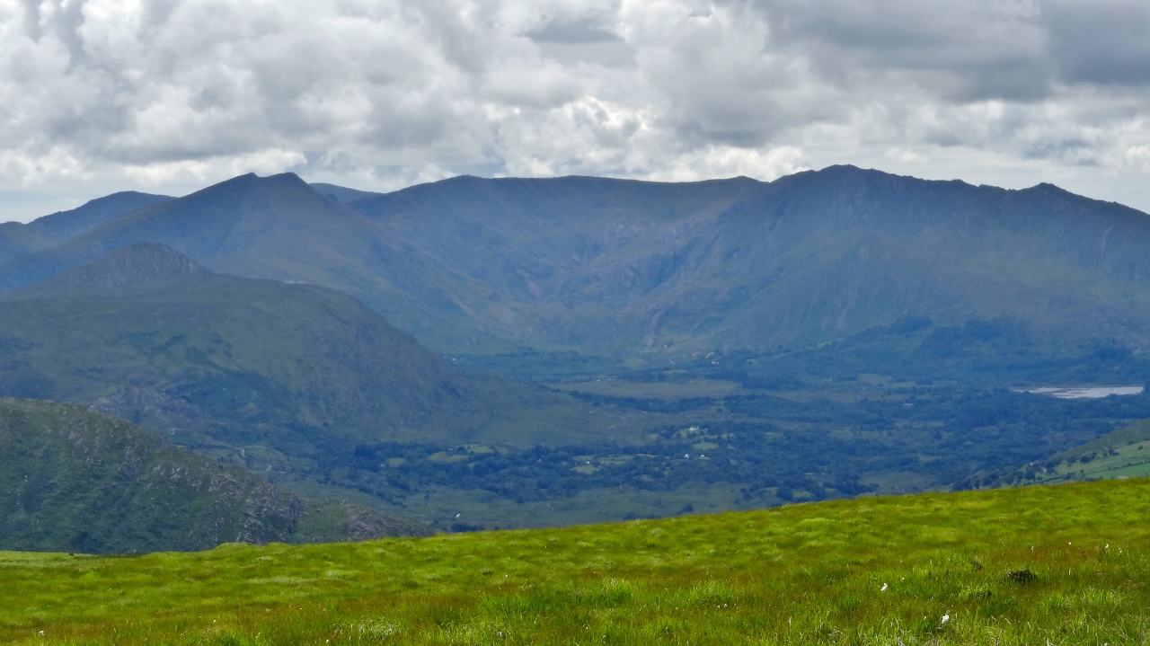
| The mountains of Rondane |
 |
| I'd give this one a miss |
All was now done and I relaxed and prepared for the long journey home. In the rain at the start it had been a bit grim but when the weather improved it only made the experience all the sweeter. The Jotunheimen area is quite different in character from the other areas I have visited. There was little evidence of the wonderful spongy mossy ground that was to be found in Dovrefell or Rondane and I guess it is caused by the higher rainfall in the area. It certainly had a more alpine feel to it with all the glaciers etc but it is also very different from the Alps. After two visits to Norway this year I am not sure that I will return next year. I missed the Pyrenees and the Alps and I think I would like to return to those places next but who can tell. One thing is for certain and that is that Norway has lots more to offer and lots more to explore. I do hope to return..