Monday 26 December 2016

The Attychran Horseshoe. A Post Christmas Hike On The Galtees

Kings yard on the right with the long spur of Knocknagantee leading to Galtymor
I went back to the Galtees today for a blast of fresh air which was much needed after the excesses of Christmas day. I opted for the Attychran Horseshoe which is a nice round of about 15 kilometers and involves about 900mtrs of climbing so it would make a decent outing. I parked at Kings Yard and walked alongside the river for a kilometer before turning and starting up the broad slopes of Knocknagantee. There was a chill brisk breeze blowing so it was a hat and gloves kind of day but it was bright and sunny and it felt great to be out. After gaining a bit of height the views, as you would expect, become a bit more expansive and it was nice to pause and look back across the valleys towards The Knockmealdowns and the Comeraghs. The summit plateau of Galtymor is called Dawsons Table and I thought I could see a bit of white on the ground but it was still a fair ways away. I pushed on and eventually I reached the slopes of the table and suddenly the wind increased exponentially in strength and by the time I crested the slope I was being occasionally being blown sideways.

Looking back at the Knockmealdowns

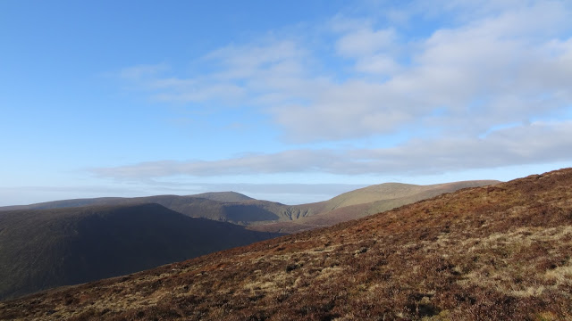
Gentle rolling and lovely. Towards Lyracappul and Temple Hill

As close as I am going to get to snow for the remainder of this year.

Lough Curra with Galtymor soaring above
There was a faint dusting of frost or snow on top and the boggy ground was nicely frozen but I didn't get too much time to enjoy it as progress was difficult in the biting wind. Thankfully the wind lulled before I reached the summit cairn and I was able to soak up the views for a short while before I turned and retraced my steps and dropped down to the easy ground that drops gradually as it curves above Lough Curra. Thankfully once off the summit the wind was more manageable and I was able to enjoy this delightful section of the outing. I followed the Galtee Wall all the way to the summit of Lyreacappul 823mtrs and after retracing my steps for about 500mtrs I was able to easily drop towards the col below Monabrack and climb the 100 or so meters to the 630mtr summit. I continued south along the spur and eventually back to my car. In total it took 4hours 15mins and it was a delight to get some sun in these short dark days.
The Galtee Wall

Lyracappul

Wednesday 21 December 2016

THE RAMP ON THE BULL...CNOC NA d'TARBH

It is a bit flattened out here but this is the start of the route..looking up from the bridge
On Sunday myself and Frank went for a final blast of mountain air before Christmas to the Kerry mountains. A fine weather day was promised and taking advantage of it I decided to have a look at "The Ramp" on Cnoc na d'Tarbh or "The Bull" as it is often called. This is a seldom used route that makes its way up the very steep ground that rises from "Turnpike Rock" and the narrow skew bridge at the narrowest point of the Gap of Dunloe. Immediately after you cross the bridge you climb up the bouldery ground, initially to the left before turning right above a rock step and aiming for a wet notch on the right of a large black rock step and the route starts here.
You can't really see it but trust me there is a big drop on Franks right side

Back down into the Gap


Exit step

It is not really difficult but it is at times very exposed and there are a couple of places that lets just say I wouldn't like to have to reverse. The first of these is at the start where you climb the dry rock on the right of the wet notch on reasonable but not "bomber" holds before you reach the steep grassy ramp above. This is followed until the ramp narrows at a notch where the rock on the left is overhanging and to progress you have to hunker down into the notch and then step to the right (good holds) onto or over the exposed edge where a very large drop awaits a mistake. It is only a couple of moves but I dare say it is not for those of a nervous disposition and the feeling is relief when you are past this spot. Follow the ramp up to almost its end and then a short easy five meter rock step awaits on the left and you leave the ramp behind. It had been ten years or more since my one and only climb of this route and I had expected that there was only a long slog to the summit remaining but after the step the way seemed barred by further large bands of black slime covered rock with horrible looking gullies between them. We traversed to the left for a hundred meters and more but we seemed to be constantly foiled by these awkward steps and we were being pushed lower and lower so we turned back (reasoning that we had missed something) and soon we spotted a way up. It was still a bit awkward and Frank lost one of his poles down a hole. We got over the difficulties, and then all that remained was the slog to the 655mtr summit. We enjoyed a nice spot of lunch here before then climbing the nearby Cnoc an Bhráca 731mtrs. After that we "enjoyed" the long walk across the bog to Strickeen and descending along the track back to the valley floor before walking the three kilometers back to the car. It had been great to climb this route again, though it is certainly one to avoid when the rain arrives. All in all it had been a lovely and interesting day. Thanks Frank.👍
Not a bad view from the summit

Suffering..more days out needed


Sunday 11 December 2016

The Hags Tooth Ridge,,,Beenkeragh to the Bone.

A nice early start saw me leave the car at Lisliebane at 08.30 and set of into the Hags Glen for another outing on The Reeks. It was quite windy and the cloud could be seen scudding across the tops of the East Reeks as I walked in. I had thought to start off by doing the Cnocnapeiste Ridge but I decided against it due to the strong wind and I opted instead for the Hags Tooth Ridge which gives a fine Grade 2 scramble (or perhaps a little harder if you pick the choicest bits) as it rises towards Beenkeragh 1009mtrs. My legs were a little tired as I had run 10K the previous day (the first time in a year 😊) and I had gone for a walk on Bweeng with Ruby but my knee was pretty good and I'm getting hopeful that the end of the injury is in sight. Anyway after a steep pull up a grassy gully I reached the base of the ridge and really enjoyed picking the best bits and I gradually gained height. Eventually the top of the tooth is reached and this is a great airy spot to rest awhile before tackling the more broken ground ahead which becomes mostly a steep slog as you near the summit. Reaching the top I sat and ate a snack and took in the views before setting off again.


Hags Tooth or Stúmpa an tSáimh


The view west
The wind was pretty buffeting and care was needed to ensure safe progress but it eased as I descended to cross the ridge towards Carrauntoohil. It is always a pleasure to cross this ridge and the pull to the roof of Ireland was soon over as well. I didn't stop and set off down to the top of the Devils Ladder before climbing Cnoc na Toinne and then Cnoc an Chuillinn where I had my lunch out of the wind. I continued on to the Bone where I turned for home. The descent went smoothly and again I was pleased with how my knee felt. I think perhaps the running is actually tightening up the supporting muscles and this seems to be supporting the ligament a bit..or at least I hope so. I reached the car at 14.20 so it had been an outing of just shy of 6 hours and all in all a very enjoyable day. Now all we want is for Santa to bring some snow😎.

Caher

The ridges of Carrauntoohils east face


Down into the Black Valley